
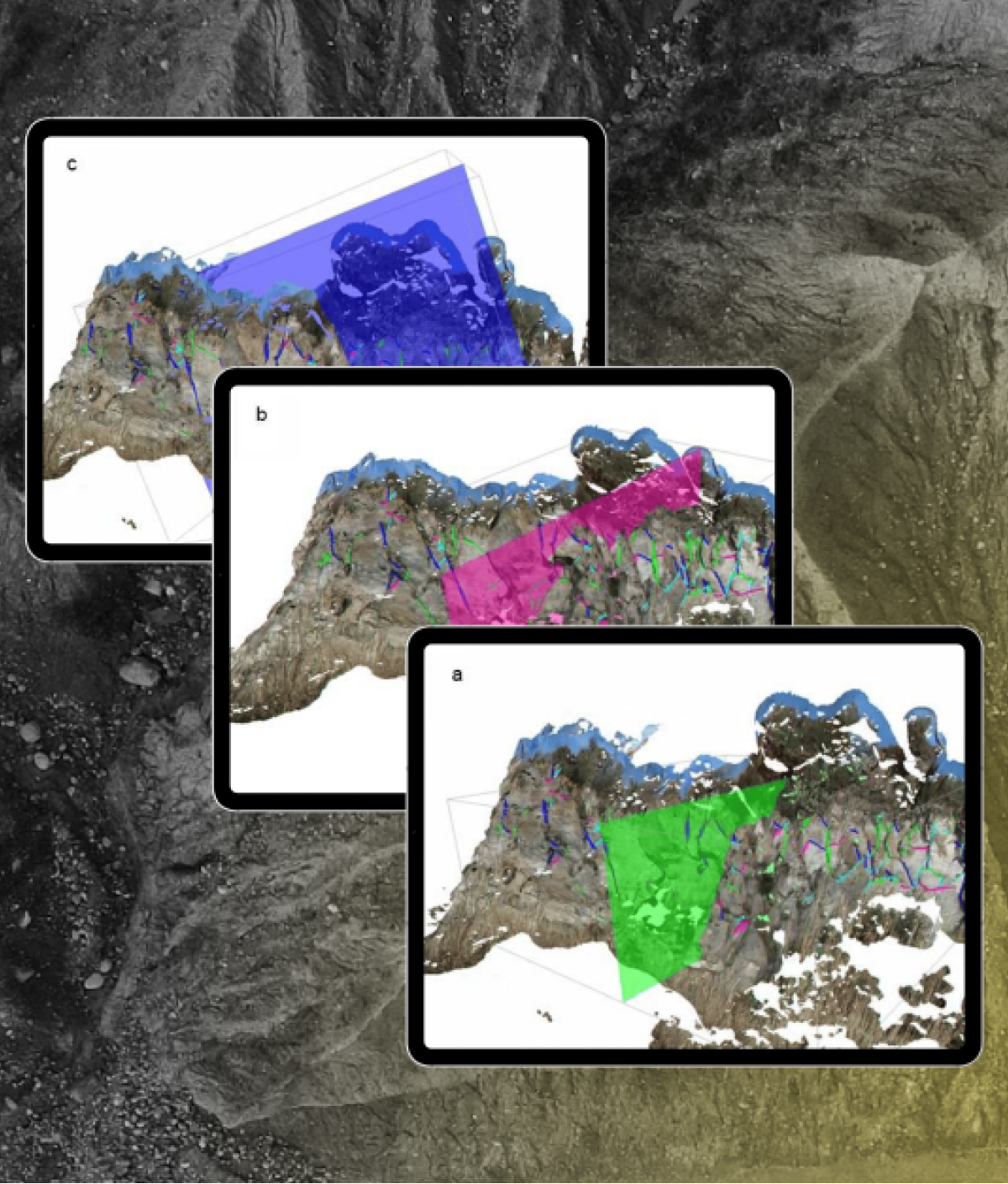
To address this issue, rockfall susceptibility analysis is crucial for localizing critical conditions to identify high-risk areas and serves as a foundation for risk analysis and implementing mitigation measures. This study uses photogrammetry-based methods and GIS-based statistical analyses to assess rockfall risk on the western slope of the Cumae Mount, helping to develop safety plans for preserving the site while ensuring secure visitor access.
ShapeMetriX: Transforming Rockfall Analysis
ShapeMetriX is a cutting-edge software solution designed for reconstructing high-resolution 3D models from overlapping digital images or existing 3D point cloud datasets, and performing contact-free, reproducible structural geologic mapping and rock mass characterization that can be used in your stability analyses. In this study, ShapeMetriX played a crucial role in identifying critical discontinuity sets for rockfall susceptibility analysis at the Cumae Archaeological Site.
The process began with a terrestrial photogrammetric survey, capturing 164 frames of the western slope of Cumae Mount.
Using these images, ShapeMetriX employed its Structure from Motion (SfM) approach to create a detailed 3D model. The software automatically performed image alignment to reconstruct the position of each frame, generated a coarse point cloud, and then created a dense point cloud (Fig 1).

To georeference the model, GPS coordinates of specific ground control points were calculated. The referencing tool in ShapeMetriX was then used to assign absolute coordinates (WGS84 system) to each point in the cloud, ensuring accurate spatial representation.
After obtaining the georeferenced 3D model, the slope’s structural and geomechanical analysis was conducted using ShapeMetriX’s Analyst tool. The geomechanical analysis highlighted the presence of a total of 118 discontinuities (Fig 2)

The geomechanical analysis followed with automatic clustering of discontinuities in Analyst using ShapeMetriX’s Automatic Joint Set Clustering feature. The optimal number of clusters was estimated as 4 and 118 discontinuities measured were automatically grouped into 4 Discontinuity Sets (DS) sharing similar orientations (Fig 3).

The Markland test performed on each discontinuity set identified potential block detachment and possible kinematic instabilities in the study area (Fig 4). Specifically:
- DS1, where the plane intersects the slope, indicates incipient toppling (symbol T1).
- DS3, which is parallel to the slope with an angle under 20°, shows potential for planar instability (symbol P1).
- The intersection of DS2 and DS3 falls within the wedge failure critical zone, represented by the symbol W1.

In the structural analysis, the slope was divided into three sectors of varying susceptibility to block detachment (low, medium, and high). These sectors were assigned values of 0.5, 0.75, and 1, respectively. The susceptibility to detachment and runout were analyzed resulting in block detachment probability and susceptibility to rockfall maps (Fig 5).

Benefits of ShapeMetriX for Efficient Rockfall Analysis
- Rapid 3D Model Generation: ShapeMetriX streamlines 3D model creation from photogrammetric data, providing a detailed geometric framework for analysis.
- Safe and Accelerated Discontinuity Mapping: ShapeMetriX offers efficient, fast and contact free structural geological mapping tools for engineering geologists and geotechnical engineers to gain critical insights into the orientation, distribution, and relationships of geological features. This reduces subjectivity and improves efficiency compared to manual methods while enabling remote and safe data collection.
- Enhanced Efficiency: Streamlined workflows and automated processes reduce the time and resources needed for data collection and analysis.
Conclusion: ShapeMetriX – Your Partner in Slope Stability
The Cumae Archeological Site case study highlights the critical need for advanced rockfall analysis in areas with unstable slopes and potential for failure. ShapeMetriX offers comprehensive tools for efficient model creation, structural geologic mapping and rock mass characterization.
Contact us today to learn how ShapeMetriX can enhance your projects.